Showing posts with label National Park. Show all posts

Tuesday, March 3, 2020

White Sands National Park


White Sands in the newest National Park. It's so new that it was still a National Monument when we left on our trip in August. As you can see, that haven't even updated the signs yet.

Several of our friends and have family sent us to @SubParParks on Instagram. She made park posters for all of the national parks with the text of their worst review. They are all amazing, but white sands it particularly spot on.


@SubParParks
To be honest, that review is what makes this park amazing. In the middle of a valley in southern New Mexico, there are miles and miles of white sand dunes. Once you are in them, the dunes are all you can see in any direction and it's magical. The trails have to have sticks marking the path so that you can find your way, any semblance of a trail would be quickly blown away.


It was a bit rainy the day we were at the park, which probably made it slightly less spectacular than it is when the sun is bright on the sand but it was still fantastic. 

The white sand comes from gypsum that was deposited at the bottom of the permian sea 280-250 million years ago (mya). 70 mya the the gypsum that had been deep under ground got pushed back up into mountains. From then until about 12,000 years ago the gypsum dissolved and ran down into the basin into a large lake. As the weather started to warm, the lake evaporated leaving large gypsum crystals which have then been broken down by, primarily by wind, into the very small sand particles that are present today. 

The sand there today is very fine and soft. Guests are invited to hike off into the dunes as long as they are taking precautions not to get lost (which would be very easy to do!). One of the favorite activities is to bring a sled and slide down the dunes. We unfortunately didn't have a sled but did enjoy hiking barefoot along one of the "trials" and trying to slide down some of the steeper hills on our bums. 


The park is also a great place to watch evolution in action. Many of the species in the park are close relatives to those found just outside of it. The park species have adapted, over time, to be more and more white, blending into their habitat. This makes for some incredible, white lizards and moths, which blended in too well for us to see on our visit.

We decided that this park was really a must see if in the area, but it doesn't really have enough to do to plan a trip solely to see it. It was incredibly different from anything we'd seen before, but we were happy with our day trip to see it.  

Saturday, February 29, 2020

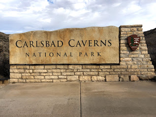
Carlsbad Caverns National Park


Very close to Guadalupe Mountains, technically still in the mountain range, is Carlsbad Caverns National Park. There is also a small amount of hiking in this national park but we focused on the caverns themselves.

Unlike Mammoth Caves, Carlsbad Caverns allows self guided tours of the natural entrance and the big room. Which was extra nice for us because entrance on those tours falls under the park entrance fee and is covered by our annual pass.


We opted to walk in the natural entrance into the big room and then take the elevator back up. This meant that we started by descending 750 feet along 1.25 miles into the cave. It was pretty steep, but mostly pretty wide. It also takes you by some pretty cool formations like the Boneyard.


The main attraction is the big room. The tour around the big room is another 1.25 miles but this time mostly very flat. There are tons of cave "decorations", or speleothems, around.


There was also some left over remnants of early cave explorers, who took this ladder 90 feet down into the lower cave. A prospect Kathleen found terrifying. 


To get back up we took the elevator, which left from the "Rest Area and Lunchroom," an area of the cave that made us giggle. It was a complete plaza in the cave, with snacks and a gift shop that seemed super out of place.


They even had restrooms that looked like you were walking off into a deep cave tunnel, 


but were actually quite nice. 


The contrast here, made this part of the cave almost feel fake. More like a Disneyland cave than an actual cavern.

Throughout our tour we couldn't help comparing Carlsbad Caverns to Mammoth Cave. Overall, the Caverns are a lot more open. The big room is "mammoth" in a way Mammoth cave wasn't. The mammoth nature of Mammoth caves comes from the fact that they stretch 419 miles, more of which is still being discovered. But they can still feel very claustrophobic. The Big Room however is nearly 4,000 feet long, 625 feet wide and 255 feet high at its highest point. As long as you can get past the fact that you are 800 feet unground, its really quite hard to be claustrophobic. There are also tight parts of the Caverns that they take guided tours too, but we didn't end up taking one.

The Caverns have many more speleothems, and are much more "spectacular," but they also feel much more "developed." While large sections of both caves are lit, a trip with a ranger into Mammoth Cave feels much more like an exploration. They will turn off the lights at one point in the tour letting you see and hear what the caves are naturally like. Meanwhile there a paved paths and handrails throughout Carlsbad Caverns, and everyone is viewing at their own pace.

Both of the cave parks we've seen so far have been incredibly fascinating and gorgeous. And also very different and unique.

Friday, February 28, 2020

Guadalupe Mountains National Park


Our next park up was Guadalupe Mountains in the Northwestern area of Texas, on the boarder with New Mexico. This park has both a lot of opportunities to hike and a lot of history, and we got the opportunity to explore both. 

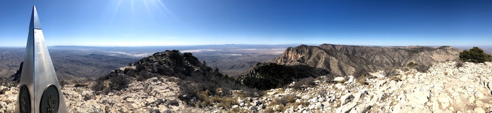
On Thursday we started by doing some of the hiking. There were a ton of good hiking option but we settled on climbing up to see the highest point in Texas. We almost turned back because we were feeling a little under the weather but we're so glad we didn't. The 3,000 feet of elevation gain over 4.2 miles up the mountain were definitely strenuous. The trail was a little bit scary at times. 


The view was worth fighting through the slight illness and fear. 


Unfortunately Kathleen's shoes have decided they've had about enough of hiking. 


On Friday, we explored the historic aspects of the park. We started with the Frijole Ranch Historical Museum. The museum is housed in an old ranch house that was built by some of the first white settlers in the area who came to ranch cattle. The house was later expanded by the Smith family who came and built an orchard. They also added a school house which doubled as a post office and community gathering area. 


Inside the house they also have information about the Mescalero Apache who lived in the area and placed great significance on the mountains, including in their origin story. Nearby parts of the park also served the Butterfield stage coach in 1858. The stagecoach was the first constant form of overland communication linking St. Louis and San Fransisco in 1858 and only ran for 11 months before a safer route opened up to the south.

After learning some of the history we took a short walk up to Smith Spring up the hill. 


We ended our exploration of the park up at McKittrick Canyon, which has been said to be the must beautiful spot in Texas. It was getting late in the day and we were pretty tired so we didn't do the full hike unto the canyon. Instead we contented ourselves with a shorter four mile out and back up the trail to just get a taste of it. 


There is definitely a lot to see in this park as there were tons more hikes that we didn't do. We both thought that coming back to do a backcountry backpacking trip would be a lot of fun, unfortunately since Aiden isn't allowed on most national park trails, now wasn't the time. But we felt like we saw a good amount of the park, and would love to come back in the future. 


Sunday, February 23, 2020

Big Bend National Park: Ross Maxwell Scenic Drive


Official NPS Map. Click and zoom in to enlarge for details.

For our third and final day in the park we decided to take on the Ross Maxwell Scenic Drive. The drive is 30 miles total down to the Santa Elena Canyon, and there are a plethora of stops and hikes to check out along the way. Because one of the highlights of the park for some people is the Santa Elena Canyon, we decided to start by driving the whole length of the road and then stop on our way back up.


The Santa Elena canyon hike (red arrow on map) is fairly short but it a little tough, you start by finding your way across a river and then going up and over a rocky pass into the canyon. It is gorgeous though!


The high walls of the Canyon can really make you feel small. 


Next we stopped at Dorgan House Trail (orange arrow on map), there was really hardly a hike here at all, mostly a walk out to the remnants of some old farm houses. We wanted to stop here because the ranger at the talk we attended in the Chisos Basin told us about the petrified wood fireplace. It was as cool as we hoped. 


Next up was the Castolon Visitor Center (yellow arrow on map). There used to be a historic town in Castalon, however it burnt down in 2019 so they are currently operating out of a temporary structure. There wasn't a lot to see here, so we got our final stamp for the park and moved on.


The trail that we decided we were both the most excited about was the Chimneys Trails (green arrow on map). The trail connects 7 miles through the desert over to a non-paved road. However, the Chimneys themselves are 2.4 miles out and can the hike can be done as an out and back. The trail is relatively flat, but completely in direct sun light and seems like it would be brutal in the summer. 


The Chimneys are very interesting rock structures sticking out of the desert. They were formed by magma seeping into cracks in other rock that has no eroded away, leaving only the mold of the cracks. 


The reason we picked this hike though was the ancient Native American art at the base of the rocks. 


The trail is also just a nice walk through the desert with great views of local flora and fauna.


After this hike we were pretty much ready to be done for the day. We stopped at the Lower Burro Mesa Pouroff trail (blue arrow on map) because it was short 1 mile out and back to get to the bottom of dry waterfall.


There is also a Upper Burro Mesa Pouroff trail that will get you to the top of the pouroff and looked very interesting. However that trail was longer, and we were starting to run out of time in the day. It is definitely on our list if we ever come back.

We made one last stop at the Sotol Vista (purple arrow) which looks out across the whole desert. It was lovely at dusk. Several people were setting up to watch the sunset, which promised to be beautiful, but we decided we wanted to keep moving and try to find our pullout before it got dark.


Overall it was a great day and a great way to finish up our time at Big Bend. We had big hopes for Big Bend and it didn't disappoint.


Saturday, February 22, 2020

Big Bend National Park: Rio Grande and Boquillas Canyon

On Saturday we were able to get another campsite in our same campground and then headed back down to Panther Junction. We were hoping to start the day by catching the park film, usually one of our favorite parts of the parks, but unfortunately the theater was broken and we were never able to see this one.

Instead we continued on with our day, heading down to the Rio Grande Village section of the park. After taking advantage of their laundry facilities we went on two relatively short hikes. The first one was a nature trail just off of the campground. This hike was only 3/4 of a mile, and it went out over  ponds and then up a small hill on a peninsula sticking out into the Rio Grande. It was a lovely.


We saw lots of wildlife, ranging from road runners to beautiful fish and turtles in the ponds. 


The hike did show us how surprisingly small the Rio Grande really is. 


So small in fact that Entrepreneurs from Mexico regularly ride their horses across the river, leaving crafts for tourists to buy by putting money in a jar, and then coming back later to collect their earnings. 


Sadly, the river was not always so small. First, due to diversions for farming irrigation and drinking water the river size was reduced to about 20% of its natural flow. Additionally in recent years the river has been suffering from reduced precipitation and increased evaporation due to climate change


There is a boarder crossing to the town of Boquillas where they will take you across the river in a row boat for $5. It sounded fun, and we were tempted by the prospect of some fresh tacos for lunch, but we ran out of time in the day. Maybe next time. 

Town of Boquillas, Mexico
We did find time for another fairly short hike into the Boquillas canyon. 


On the way back to Panther Junction we did one more easy hike at a location called dugout wells. This hike had signs along the way telling us about the different cactus and animals that live in the area and how they have adapted. All three hikes were nice because they were completely different ecosystems. 


We wrapped up the day with another ranger program, this time down at the Panther Junction Visitor Center. This one was about night sky and the history of astronomy. It was super interesting and ended with telescopes set up in the parking lot. Big Bend is a gold tier dark skies park, meaning there is little to no light pollution. We lucked out and were in the park with a new moon so the stars were extra spectacular. Unfortunately we don't have the right equipment for spectacular night sky pictures.